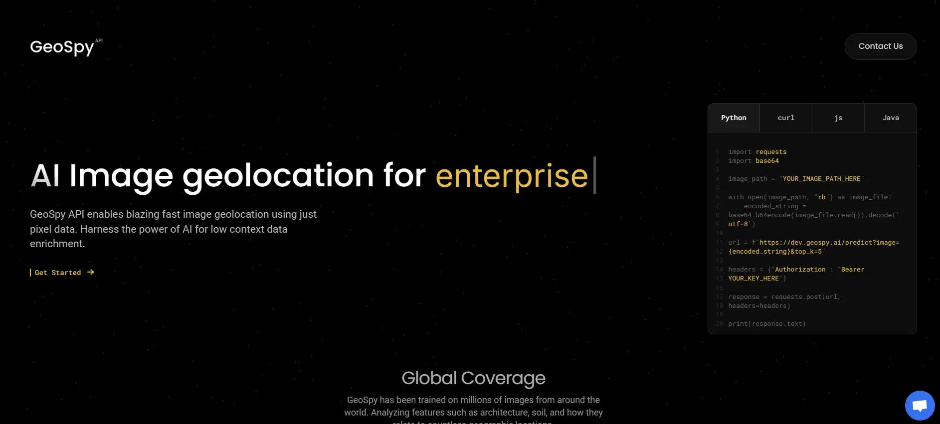
GeoSpy API Overview
The GeoSpy API is a sophisticated tool designed to infer the geographical location of images using advanced AI and machine learning techniques.
By using advanced algorithms and machine learning, GeoSpy examines visual features such as buildings, vegetation, and landmarks within an image to provide precise location estimates. This tool is particularly useful in various fields, including OSINT investigations, journalism, law enforcement, and disaster response.
Key Features
- Geolocation Inference: The core feature of GeoSpy is its ability to determine the likely geographical location of an image based solely on pixel data. This makes it a powerful tool for applications where GPS data is unavailable or unreliable.
- Image Classification: In addition to geolocation, GeoSpy offers image classification capabilities, allowing users to categorize images into predefined groups.
- Clustering Support: If multiple geolocations are close to each other, the API can predict several possible locations for a single image, enhancing the accuracy of its predictions.
Use Cases and Applications
- Travel and Tourism: Companies in these sectors can use GeoSpy to enhance user experiences by providing contextual information about photos shared by travelers.
- Security and Surveillance: Organizations can utilize the API to verify the authenticity of images or identify locations in security footage.
- Social Media Platforms: Enhance user engagement by automatically tagging or suggesting locations for photos uploaded by users.
- Research and Analytics: Researchers can use GeoSpy to analyze large datasets of images for geographic trends or patterns.
Best Suited For
- A reliable method for determining image locations without GPS data.
- Tools for enriching datasets with geographic context.
- Solutions that integrate seamlessly with existing applications via a RESTful API.
Getting Started
To begin using the GeoSpy API, you’ll need an API key from Graylark Technologies LLC. With this key, you can access various sample codes available on platforms like GitHub to integrate the API into your applications. Ensure you have Python 3.9 or later installed, along with necessary libraries, to make the most of the provided sample codes.
Tips for Effective Use
- Ensure high-quality images are used for better prediction accuracy.
- Utilize clustering features when dealing with images that have multiple potential locations.
- Regularly update your application with new image data to keep predictions relevant and accurate.